I
would generally describe myself as an experienced urban cyclist. I’ve
spent the better part of the last decade bicycling as a primary means of
transportation in Seattle and Olympia, Washington. My recent move to
New York City has changed my habits significantly. The ease of use of
best public transit our nation has to offer, combined with the
intimidation of traffic and pedestrians has left my bike idle most days.
I was an experienced urban cyclist, but New York is a different animal entirely.
For
my first real cycling excursion I chose to simply commute to school
using the first route advised by Google Maps for cyclists. Using the
subway as a primary means of travel on a daily basis, I have little
understanding of how neighborhoods connect above ground or what roadways
would be best, so this would also be a test of Google’s suggestion. I
jotted down the directions on a piece of paper, placed it in my jacket
pocket for easy access, and intentionally decided not to use my phone
for directions but to rely primarily on road signage to guide the way.
My path would take me through Prospect Park, up Vanderbilt Avenue, over the
Manhattan Bridge, across Prince Street to West Side Bike Path. Here’s
the map and stats:
***********************October 11
Left at 10:45am - Arrived 12:30pm (1h 45min)
Total Distance: 16.5 miles
Average speed: 9 ½ mph
Trip Path:
View Larger Map
Separated lane:
70% (11.6 miles)
Bike lane or sharrow:
22% (3.6 miles)
Mixed with traffic:
8% (1.3 miles)
***********************
Throughout
the trip I was pleased and impressed by what I found. I referred to my
direction cheat sheet only once. Signs clearly guided the way most of
the time and the amount of separated bike path I encountered was delightfully
shocking. I had prepared for the worst and discovered I had little
reason to be worried. I shared these pathways with a steady stream
of bicyclists, which added to the feeling of road safety because a
consistent flow helps to ensure bikes are seen and given adequate space
on the roadway by other commuters. Much of my route was surrounded by
greenspace and views of trees and water while many of the most dangerous roadways
provided clearly marked pathways separated by barriers, curbs, or road
markings. Overall, the trip made me appreciate the city in an entirely
new way, helping me to understand the layout and the connections from
one part to another.
 |  |
| Just a few feet of separation make a huge difference | Two-way bike path separated by barriers from busy traffic |
 |  |
| Flying over the bridge | West Side Bike Path |
 |
| I can deal with 100 blocks of this view |
The
positive experiences of my trip far outweighed the negatives, but the
few uncomfortable moments were not be ignored. In total I shared the
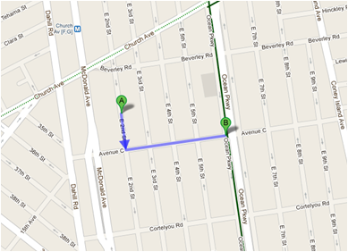
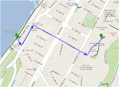
roadway with car traffic for only 8% of the trip, but that fraction
(depicted in the following three map screenshots) contained the only stressful
moments. Sharing the roadway means getting buzzed by cars and trucks
while constantly watching for opening doors and dodging pedestrians. These tend to be the slowest portions of the trip due to constant stoplights or stop signs, which some cyclists blow right past. For some unfortunate reason Google Maps instructed me to take a left on
Delancey Street as I crossed Manhattan. Bad move. These few blocks
were flat out awful, and I quickly became that crazy guy on the bike
between two giant, moving delivery trucks. Once I returned to the
safety of a bright green bike path on Prince Street I could breathe easy
again. The next step of bike planning for New York City concentrate on
these connection issues. I was astonished at the ease of navigation and
aesthetic enjoyment of my trip, but I can understand how these few
tricky intersections would be enough to deter less confident riders.
Bad intersections for bikers are usually just plain bad intersections
for everyone. By focusing attention to thoughtful multi-modal traffic
engineering on these trouble spots we can all benefit from a safe,
integrated bike network that separates bikes and cars, giving each the
space they need.

My
trip to school will not be something I intend to repeat with frequency, but this
is due to a simple matter of distance. Daily round-trip travels totaling 33
miles and nearly 4 hours are just not practical for me. If I were
employed in lower Manhattan I would absolutely consider it. Flying over
the East River on your bike is a remarkable way to start your day, and I
now know that by marking out a path I can commute to most places in the
city quickly and safely. I averaged 9.5 mph, which is a similar speed
to average Manhattan car trips. Unlike car trips, I will get the added bonuses of healthy
exercise, money savings, and the freedom afforded by urban bike travel. I'm happy to have taken this challenge and grown in my knowledge and appreciation for bicycle infrastructure in New York while overcoming my fears. Although my reverence for the sometimes maddening complexity of these streets will remain, I have a better understand of the niche that exists for bicycles.
-John Druelinger
-John Druelinger


