Last week I decided to document my bike ride to work. Starting from my apartment in Crown Heights, by the Brooklyn Museum, I headed up through Prospect Heights into Boerum Hill, Downtown Brooklyn, and DUMBO, to reach the Brooklyn Bridge. On the other side of the bridge, I followed a series of potential bicycle routes from City Hall through to the Financial District.
First, I headed north on Washington Avenue, across the busy Eastern Parkway through to Prospect Heights. The intersection at Washington and Eastern Parkway, both wide and heavily used roadways, as well as the site of the Brooklyn Museum, has several brightly painted bike lanes. These connect the the sidewalk protected bike path running West-East on Eastern Parkway. However, the bicycle lane going north and south on Washington Avenue doesn't connect as neatly to a bicycle path. The path North seems to connect to the parking lane on the other side of Eastern Parkway. It would seem to be safer if the bright path extended and curved around the parked cars.
 |
| Looking North on Washington Ave and Eastern Pkwy |
On the other side of Eastern Parkway, in Prospect Heights, the bike lane turns into a shared lane. The markings here are faint and often disregarded by drivers. It seems this corridor would be much safer if the vehicle lane was narrowed and the parking space on the right side was expanded to incorporate space for bicycles.
 |
| Shared lane on Washington Ave looking North |
 |
| The shared lane turns into a bicycle lane around Sterling Place |
After this, I took a left to go west on Bergen Street, where the bicycle lane seems to be protecting the parked cars. This actually seems to work as trucks and other commercial vehicles can stand without cutting the flow of vehicle or bike traffic (see photos below).
 |
| Bergen Street bike lane, heading west |
From here, I turned right to go north on the Smith Street bicycle lane. This bicycle lane is generally slow and seems safe, but the traffic around Atlantic Avenue takes over the bicycle lane and most bicyclists weave through any gaps they find in the traffic. This seems dangerous and perhaps is a good place to installed protected lanes.
 |
| Smith St at Atlantic Ave, bicyclists seen on left as opposed to the bike lane |
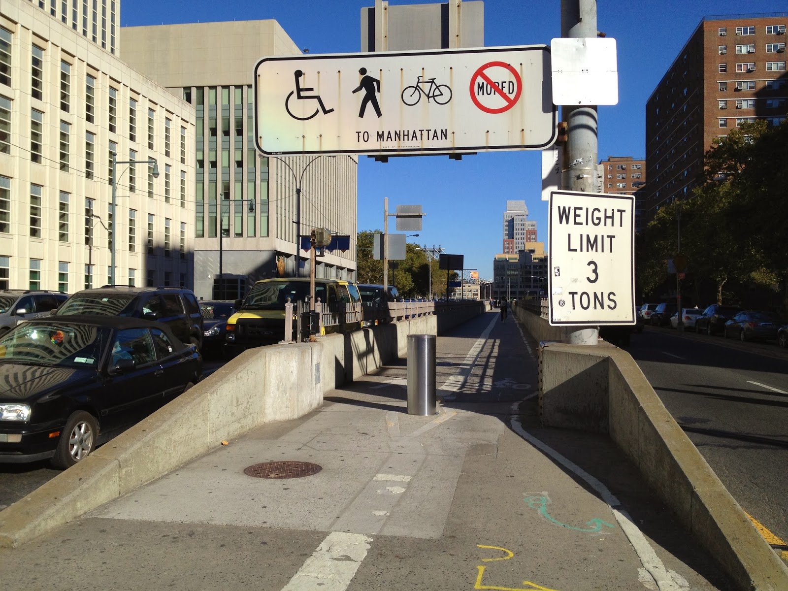
Following Smith Street, which turns into Jay Street, I made a left onto Tillary Street, to make a right onto the Brooklyn Bridge Promenade.
 |
| Entrance to the Brooklyn Bridge |
Bikers tend to complain about the Brooklyn Bridge, but during morning rush hour, it is not very crowded and offers a great view to motivate you at the beginning of your day! In the evening the bridge is more crowded, so I tend to take the Manhattan Bridge, but if you're not in a rush to get home, why not bike slow and enjoy the view?
 |
| Brooklyn Bridge, underrated |
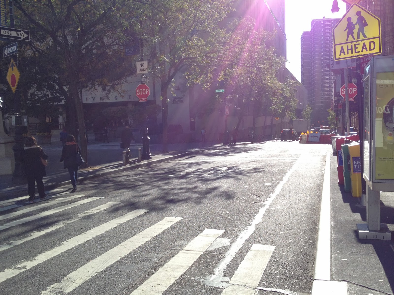
Getting off of the bridge, I took a series of potential (and much needed) bike paths. After making a left onto Centre Street, I made a left onto Spruce Street.
 |
| Spruce St can use a bike lane, esp. because of construction, seen ahead |
After this, I made a right onto Gold Street, which serves as a standing area for many ambulances and double parked cars. This street can really use a protected bicycle lane, perhaps one running both ways on the opposite side of the hospital.
 |
| Gold Street facing South |
After Gold Street, I made a left onto Fulton Street and then a right on Water Street. Both of these streets see bikers competing with motor vehicle traffic all of the time. They should definitely have shared lanes, at the very least.
 |
| Fulton Street facing West |
 |
| Water Street facing South |
In summary, this ride seems safe, for the most part, even during rush hour. There is definitely a need to expand bicycle lanes in lower Manhattan, besides those on the Hudson and East Rivers. This a business district/commuter area that seems apt to host bicyclists coming in from the bridges.


No comments:
Post a Comment